GeoNetwork IIAG
Plan de Uso de Suelo La Paz y Cochabamba (sin norma legal)
Simple
- Fecha ( Publicación )
- Estado
- En proceso
- Mantenimiento y frecuencia de actualización
- A discreción
- Palabras clave ( Tema )
-
- plus
- Palabras clave ( Lugar )
-
- World
- Restricciones de Acceso
- Copyright
- Restricciones de uso
- otherRestictions
- Tipo de representación espacial
- Vector
- Denominador
- 5000
- Idioma del metadato
- en
- Codificación
- UTF8
- Categoría temática
-
- Medio ambiente
))
- Información Suplementaria
-
You can customize the template to suit your needs.
You can add
and remove fields and fill out default information (e.g. contact
details).
Fields you can not change in the default view may be accessible in the
more
comprehensive (and more complex) advanced view. You can even use the
XML editor
to create custom structures, but they have to be validated by the
system, so
know what you do :-)
- Identificador del Sistema de Referencia
- WGS 1984
- Recurso en línea
- https://gtggeoportal.umsa.bo/geonetwork/srv/api/records/5a701ddf-eaaf-4952-8ffc-0a227c5330eb/attachments/LPZ%20-%20CBBA.rar ( WWW:DOWNLOAD-1.0-http--download )
- Jerarquía
- Conjunto de datos
Overviews
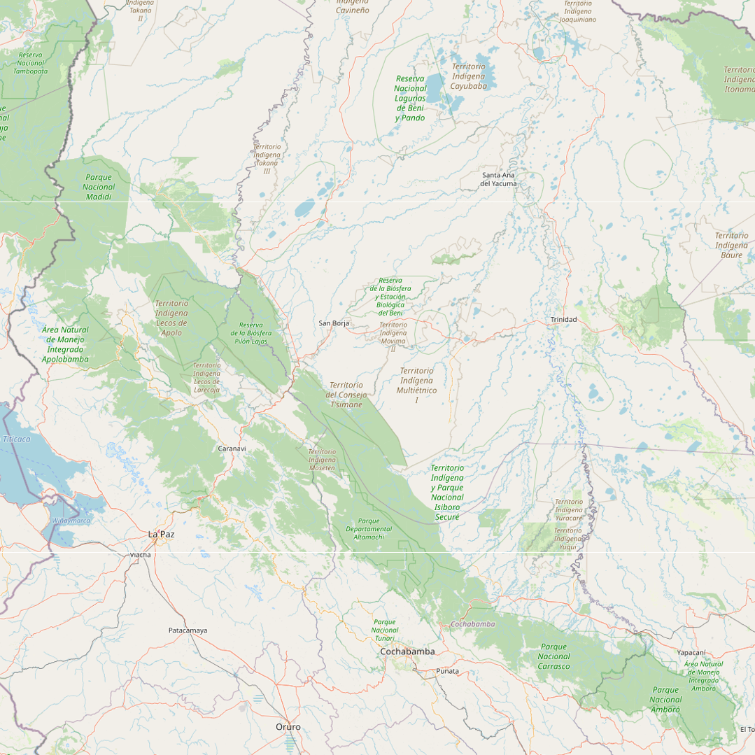
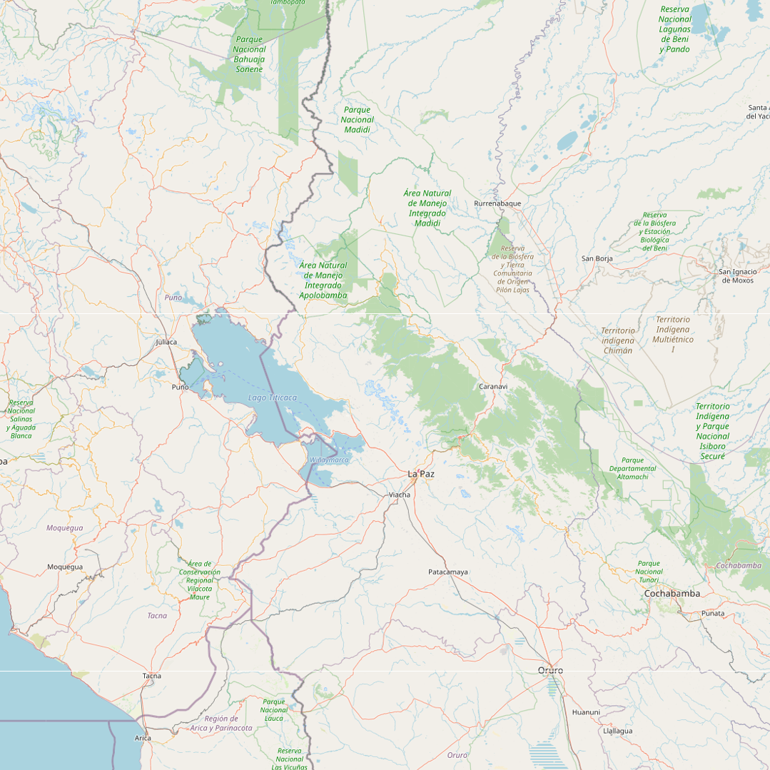
Extensión espacial
Provided by